This is a section of the river along the northwest border of Alamosa, CO.

This is a section of the river along the northwest border of Alamosa, CO.

This very distant view is from the Bluff Overlook in the Alamosa National Wildlife Refuge, just south of Alamosa, Colorado.
Early Fall near Alamosa campground in Rio Grande National Forest.

A nice place to relax within an easy drive from Alamosa; dirt road is sketchy in places though. This view is from the Bluff Overlook. I drew this on my iPad.


For Sarah
This drawing was one of two that I did during the December plein air event in Scappoose, Painting to Save the Trees. Sarah Lamberson was the pioneer wife who moved here with her husband in the 1830s. They were among, if not the first, non-Native Americans to occupy this land. They came via the Oregon Trail. The Scappoose Historical Society is compiling a history of the Lamberson family. They had quite a life. Sarah died at age 48 and is buried on the property alongside two infant sons. Their grave markers are barely visible among the four oak trees in the distant right of my drawing.

The purpose for the painting event was to draw attention to the old trees. The land went through many ownership changes and is now for sale. If and when that happens, the trees could be lost to development. The land is also quite historic as it is the last large tract of land in the area that was used by native peoples as a gathering and trading site. According to records (2nd hand info to me), the Scappoose area, prior to White settlement, had the largest concentration of Native Americans (several tribes) in the entire Americas.
My journey into the wilderness
Note: I will add my drawings from this trip to my Artwork page and I will also share some of them on Instagram (@michaelliebhaber)
Trip Highlights

I took a short trip last week to Badger Lake on Mt. Hood (Oregon, USA). My friends came along for company. Badger Lake is one of the few (the only?) wilderness campgrounds to which one can drive on the mountain. It’s a remote, small, spring-fed lake at 4400 feet (1340 meters). The main feature, at least in my opinion, is psychological: I encountered no one on my drive to the lake. When I stopped my Jeep (2003 Liberty 4WD) I was struck by the silence. There was no noise, none. There were no people, no cell service. I was alone.

I took the road less traveled, the short cut, which requires a high clearance vehicle for the entire 14-ish miles. Most of the road is rough natural terrain (rocks embedded in soil) with some pure rock stretches (scree or talus) and clings to steep mountainsides.
Trees lined the road in most places, however, there were a few exposed parts; places where there were no trees below me, the road was just wide enough for my vehicle, and with very steep 200-300 foot drop offs below. And then there were the scary bits! Overall, it was a punishing drive on my vehicle and me.
I arrived at the campground just before dark, exactly 100 miles from my start at Scappoose. I selected a spot that had a peek-a-boo view of the lake. I slept in my jeep – water proof, bug proof, bear proof, and (almost) big enough for me. I awoke to find that the setting was very pleasant. The lake was only about 1/3 full because of the dry summer and evaporation. Some people came to kayak in the early morning, but I think they were deterred by the mud surrounding the water. The only wildlife I saw were birds, chipmunks, and an occasional squirrel. Deer and horse tracks crisscrossed the area.
The photos below are at the campsite and the lake.


I took the recommended route out (26 miles). Much nicer. I think I saw my jeep smiling. I decided to camp at Trillium Lake. My spot in the tent camp area was a one minute walk from one of the most photographed views of Mt. Hood, so I took picture! The next day I drove up to Historic Timberline Lodge, where I took the close-up photo of the mountain – the one with my traveling companions! They were disappointed. The Forest Service Ranger said they could not climb the mountain because they did not have the proper equipment. My little friends argued that, because they were animals, they did not need equipment. The Ranger countered that real animals don’t talk and are not stuffed. At which point Foxy attempted to bite the Ranger because “That’s what animals do.” Thus ended my visit to Timberline Lodge and Mt. Hood.


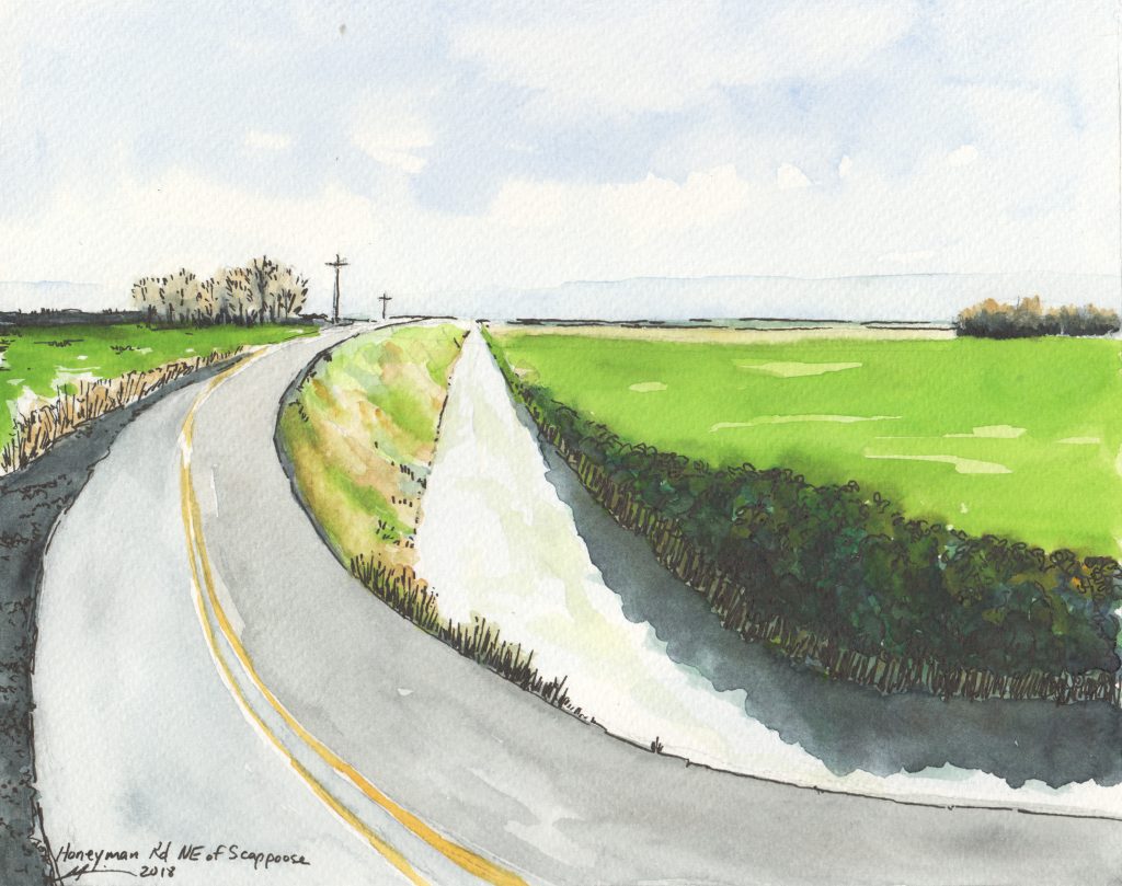
Farm Drainage Ditch: 45.8, -122.8
8in x 10in / Watercolor & Ink
February, 2018
Story: One of many farm ditches near Scappoose. This one is along East Honeyman Road.
All content © copyright 2005-2018, Michael J. Liebhaber